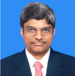
Academic Identity
-
 Orcid Id 0000-0002-2305-5288
 -
 Researcher Id AAS-7277-2020
 -
 Google Scholar Id _J_frrkAAAAJ&hl
-
Prof Palanivel K
- Professor
- Bharathidasan University
Publications 1997 - 2020
Publications
-
24
Journal Articles
-
16
Book Chapter
-
9
Conference
Proceedings -
19
Projects
Citations / H-Index
 7
Citations
Google Scholar

Expertise
Geology
Application of Remote Sensing, GIS and related technologies (Geoinformatics) in Geology in general and management of Natural Resources and Geohazards, such as: i. Water Resources Prospecting, Conservation and Management ii. Hydrocarbon prospecting iii. Heavy Placer Mineral Resources prospecting & mapping and iv. Natural Disaster / Geohazard Zonation, Mitigation and Management – Landslide, Tsunami, Flood, Seismicity and Soil Erosion v. Query Based Spatial Information Retrieval Systems (QU
Personal Information
Prof Palanivel K
MaleExperience
-
Professor
Centre for Remote Sensing
Bharathidasan University
-
Associate Professor
Bharathidasan University
-
Assistant Professor (Grade-III)
Bharathidasan University
-
Assistant Professor (Grade-II)
Bharathidasan University
-
Assistant Professor (Grade-I)
Bharathidasan University
-
Research Scientist
Bharathidasan University
-
Research Associate
Bharathidasan University
Qualification
-
P.G.D.C.A.,
Alagappa University, Karaikudi
-
Ph.D., Earth Sciences - Geological Remote Sensing
School of Earth Sciences, Bharathidasan University, Tiruchirappalli
-
M.Sc., Geology
Annamalai University, Annamalai Nagar, Chidambaram
-
B.Sc., Geology
Alagappa Government Arts College
Doctoral Theses Guided
Geomatics based Integrated Approach in Delineating Geologically Favourable Coastal Belts for Placer Mineral Accumulation in Northeastern Coastal Tract of Odisha, India
Smita Priyadarsini Rout, Department of Remote Sensing, Bharathidasan University
Geomatics and Information ValueBased Geosystem Modelling for Placer Mineral Targetting in Parts of Southern Odisha Coast, India
Kathiravan R, Department of Remote Sensing, Bharathidasan University
Groundwater Inventory and Management using Analytical Network Process Model in Hardrock Aquifer System in and around Tiruttani area, Tamil Nadu, India
Rajani R, Department of Remote Sensing, Bharathidasan University
Geospatial Technology based Water Resources Management in Goa State, India
Jeyachandran N, Department of Remote Sensing, Bharathidasan University
Geomatics Based Artificial Recharge Schemes in Hard Rock Aquifer System-Karur District, Central Tamil Nadu, India
Muralitharan J, Department of Remote Sensing, Bharathidasan University
Geospatial Technology for Enhancing Oil and Gas Exploration Techniques, Part of Sabatayn Basin-Yemen
Arafat Mohammed Bin Mohammed, Department of Remote Sensing, Bharathidasan University
Membership In Professional Bodies
Tamil Nadu Science Forum (TNSF), Madurai, 2011, L.M.No.: 267
Life Member
Mineralogical Society of India (MSI), Mysore, 2010, Fellow L.F. No. 268
Life Member
Swadesi Science Movement, Kundrakudi. 2010, Life Fellow No. 28
Life Member
Tamil Nadu Science Forum (TNSF), Madurai, 2011, L.M.No.: 267
Life Member
Mineralogical Society of India (MSI), Mysore, 2010, Fellow L.F. No. 268
Life Member
Swadesi Science Movement, Kundrakudi. 2010, Life Fellow No. 28
Life Member
Indian Society of Geomatics(ISG), Ahmedabad - September 15, 2002, Fellow No. ISG-L-599
Life Member
Geological Society of India (GSI), Bangalore – October 30,1997, Fellow LM.No. 1175
Life Member
Indian Society of Remote Sensing (ISRS), Dehradun – May 01, 1996, Fellow No. L-1449
Life Member
Membership In Committees
NAAC-Consolidation Committee, Bharathidasan University – 2017-18
Member
Doctoral Research Committee in Bharathidasan University, Tiruchirappalli (from 2005 till date), Department of Planetary Science, Periyar University, Salem; Department of Applied Geology; Gandhigram Rural Institute-Deemed to be University, Dindigul
Member
JRF / JPF / Project Fellow Selection Committee, DRS (from 2005) & CDAP, BDU(2020) and Gandhigram Rural Institute-Deemed to be University, Dindigul (2013 & 2018)
Member
Passing Board Committees, Centre for Remote Sensing, BDU and KUFOS, Panangad, Kochin (2017), Department of Geology, BDU (from 2020)
Member
Department Research Committee, Centre for Remote Sensing, Bharathidasan University
Member
Department Purchase Committee, Department of Remote Sensing, Bharathidasan University,
Member


